Surface Water
Toddington is on top of a hill. The surface water from the east side of the village flows into the River Flit and on towards Westoning & Flitwick. The water from the west of Toddington flows into the Ouzle Brook through Hockliffe and on to Leighton Buzzard and Milton Keynes. While walking the footpaths of village it has been interesting to see how the watercourses all connect.
The map below indicates the approximate boundaries, which reflect the high ground. It is interesting to note that many of the roads, B5120, Park Road, Woburn Road and the Boundway byway (south of Chalton) follow the high ground. Our forebears clearly found these better (less mud) for travel.
The government flood risk map demonstrates that the greatest risk is to the surrounding low laying farmland, and adjacent to some of the water courses.

East of Toddington – River Flit
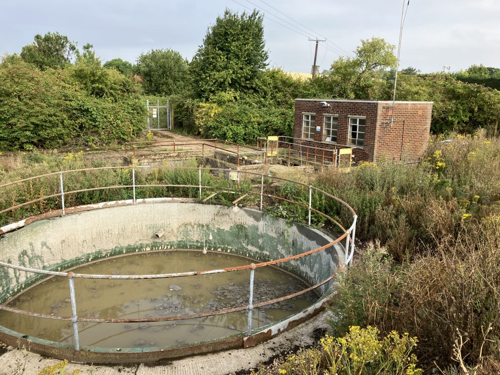
The source of the river Flit is just to the east of Chalton village, where natural springs form a water course. The watercourse continues past Chalton waste water treatment works where the treated effluent is discharged to the north of the works into the river Flit.
The road gullies in Toddington high street discharge into the village pond. From the pond the water flows in a culvert under the road in Wentworth Gardens to find its way to a stream at the bottom of the footpath at the end of Conger Lane. From there it flows onto to join the River Flit.
The bridleway from Chalgrave church towards Chalgrave Manor has a watercourse which flows down past the formal fisheries at the Fancott under the road by the Fancott pub to join the river Flit in the fields beyond. Similarly the ponds on Chalgrave golf course feed the ponds to the south of Chalgrave Manor which then join the watercourses coming from the fields up to the Boundway.
The ponds around Toddington Park and Toddington Manor run down to a watercourse under the M1 junction 12, this then joins the river Flit just north of Poplars garden centre by the roundabout.
West of Toddington – Clipstone Brook
The Clipstone Brook arises in the fields on the Toddington/Milton Bryan parish boundary and drain all the fields between the Woburn Road, Milton Bryan, Toddington and Wingfield.
The rainwater and road gullies in the roads around Willow Way and Bryant Way find their way into the watercourse in the Glebe. The new development of the Hayfields has a ‘balancing pond’ before the water slowly joins the watercourse in the Glebe. The Randall Road area drains into some large tanks under the Glebe (see manhole covers in grass near the car parking area) which then slowly discharges into the Glebe water course. The watercourse then follows the footpath down to the Toddington Road in Tebworth, where it joins other watercourses and continues to form the Clipstone Brook flowing under the A5 just north of the traffic lights in Hockliffe.
There is a river level gauge on the Clipstone Brook between Hockliffe and Leighton Buzzard. When we have rainfall in the area the river gauge reacts within hours to the increased water flow. The example below (1st Jan 2025) shows the rainfall starting at 10am and the river level monitoring peaking by 5pm.


Foul Water or Sewage
The surface water and foul (sewage) water from all households in Toddington is separated, we do not have a “combined sewage system” like some parts of the country. This allows the foul water to flow to the sewage works and surface water to flow (sometimes via a ‘soak away’) to the watercourses identified above. Never use the surface water system (eg road gullies) for disposing of oil, paint or other unpleasant liquids as these will enter the natural environment untreated and harm wildlife.
The foul water from Toddington runs through sewers under the road to join with several pipes under the fields which flow to a large tank at Cowbridge. From Cowbridge the foul water is pumped to Chalton sewage treatment works, then the treated water flows back into the river Flit. The map below shows the approximate route of the sewage pipes from Toddington to Cowbridge.
There are small pumping stations in Randall Drive and Willow Way that pump sewage up over the hill to get to the east of Toddington so that it gravity flows to Cowbridge.

Details of the most recent discharges are shown on the Anglian Water website search for Toddington, then click on the icons for more detail of the most recent discharges. I started researching the discharges due to a planning application in Toddington that Anglian Water responded to indicating there was no capacity constraints. I highlighted to them that there were regular discharges and, to be fair to Anglian Water, as a result they changed their response to a objection to the planning application as it would increase the frequency and volume of raw sewage discharges.
The Anglian Water map shows the that Toddington has four storm overflows at Park Road, Conger Lane and Luton Road which discharge raw sewage to the surface water courses in the event of heavy rainfall. (Conger Lane outfall is pictured on the right). The storage tank at Cowbridge stores the sewage and pumps it to Chalton sewage treatment works, but when this tank is full, it discharges raw sewage directly into the river Flit. On Jan 1st Toddington received 10mm of rain in three hours and this caused Cowbridge to overflow for 1hr 31m directly into the river Flit. To prevent this occurring a larger storage tank is required. I can not identify any plans for such future investment.
Anglian Water have provided the recorded discharges for the calendar year 2024, as follows:
- Park Road – 0.5 hours
- Conger Lane – 11.25 hours
- Luton Road – 11.25 hours
- Cowbridge – 242.00 hours
- yes, that is the equivalent of 10 days of discharge over the year
- the longest discharge started on 22 Sept at 16:00 and stopped on 24 Sept 15:00 – virtually 2 days of continuous discharge

Anglian Water have a licence from the Environment Agency to permit this discharge subject to a number of conditions. This permit was updated in Feb 2024 (at the time of writing). A copy the permit issued in Feb 2024 has been obtained from the Environment Agency, permits can be requested from the EA website.